News
IONOLAB Project takes place in TUBITAK's Success Stories Book
August 19, 2014
Our department's "Regional Automatic TEC Mapping and Monitoring" project took place in the Success Stories book of TUBITAK, the Scientific and Technological Research Council of Turkey.
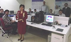
Research fellows from our department, Bilkent University and Turkish Army's General Command of Mapping collaborate within the project conducted by our faculty member Prof.Dr. Feza Arikan. The project is financially supported by TUBITAK - ARDEB, the Directorate of Research Support Programs.
The Turkish-only version of the Success Stories book can be viewed online by clicking the following address:
http://www.tubitak.gov.tr/sites/default/files/content_files/iletisim/tanitim_materyalleri/ardeb/basari_oykuleri.html#54
Also, you may visit our department's Ionospheric Research Laboatory Web site for more about the project:
http://www.ionolab.org
The abstract of the project is as follows:
Space Weather consists of a highly variable medium that is very important for data accuracy of remote sensing and communication satellites and security of Low Earth Orbit satellites. With recent studies, it has been shown that solar flares, sun spot number, solar wind, interplanetary magnetic field, magnetosphere of the Earth and seismic activities in Earth's lithosphere all play important roles in Space Weather.
The Earth's ionosphere is the most sensitive layer of the atmosphere to variability of the Space Weather due to its highly conductive structure that is a complex function of all the physical phenomena listed above. Ionosphere consists of high electron concentrations and extends from 60 km to 1000 km above Earth's surface. The dense electron concentration forms a highly conductive plasma structure that varies with respect to changes in time, frequency, position, Sun's activity and geomagnetic field.
Total Electron Content (TEC) is one of the major parameters of the ionosphere. TEC is defined as the number of free electrons in a path of 1 m2 cross-section. The variations and disturbances of the Ionosphere can be obtained effectively and efficiently by monitoring and computing the Total Electron Content (TEC) due to the fact that TEC is a complex function of various parameters such as solar activity, Earth's magnetic field, variability period of sun spot number, position, season, date and time. Although TEC is a major variable in monitoring and investigation of Ionosphere and Space Weather, it can only be obtained as a byproduct of systems that have been in use for other purposes and suffers from sparsity in both time and space. Therefore, the computation, estimation and modeling of TEC in space and time are active research areas in Space Weather studies.
In order to determine the space-time variability of the ionosphere, electron density distribution and TEC, existing techniques that can be found in open literature are implemented in TUBITAK grant no 105E171 and new techniques have been developed for the first time. A database has been established with the estimated TEC from a limited number of measurement campaigns. Researchers and students from Hacettepe University (HU), Bilkent University (BU) and General Command of Mapping (GCM) actively collaborated for not only the assessment of existing techniques and results in open literature but also development of new areas of research that have never been investaged before. GCM established a new extended GPS receiver network in 2008 by the grant TUBİTAK 1007 TUSAGA-Aktif/CORS-TR through which high resolution data in space and time can be obtained from Turkey and North Cyprus. Through this new and extended GPS receiver network, the application of the developed techniques in TUBITAK 105E171, development of new methods that would better represent ionosphere over Turkey by making use of new high resolution measurements from the GPS network, high resolution space-time interpolation and modeling of ionosphere for geodetic and space weather applications, and monitoring of seismic activity using TEC are all made possible.
One of the major goals of the proposed project is the extension of single receiver TEC estimation technique developed in TUBITAK 105E171 to the multi-receiver/multi-satellite systems that are made available with the homogeneously distributed GPS receivers in TUSAGA-CORS network. With the proposed project, interpolation with anisotropic Kriging will be applied to TEC mapping for the first time in literature and high resolution space-time regional TEC maps of Turkey will be obtained. The second major goal of the project is the optimization of semivariogram function of Kriging interpolation method for automatic generation of TEC maps that will allow continuous monitoring and investigation of the ionosphere.
Currently, the experimental semivariogram curves of Kriging methods are fitted manually to the theoretical functions and the methods that will be investigated for automatic fitting and optimization of parameters will be tried for the first time in the literature in this area. The third goal of the project can be given as the automatic investigation and examination of generated TEC maps using advanced image and signal processing algorithms. This way, the strength and distribution of the variability in TEC can be identified locally and the causes for the variability can be classified.
The final goal of the project is the statistical characterization of local space-time variability of TEC in regions close to the earthquake fault zones in Turkey and development of a possible earthquake alarm signal or a precursor.
The researchers of the proposed project consists of four professors from Hacettepe University and Bilkent University, Departments of Electrical and Electronics Engineering, who are all experts in their own subdiciplines and six researchers from General Command of Mapping (GCM) who are all highly experienced in the establishment and operation of GPS stations, and the collection and geodesic and seismic analysis of GPS data.
The project will be completed in three years. This study will be the first in the open literature in terms of duration and time resolution of the ionospheric monitoring. Very important and original techniques will be developed in this project. The results of this project will be submitted to SCI cited journals and they will be presented in conferences.
More news